In which we explore some new trail, offer praise (and offer some help, too)
Duana and I took Hana and the Dragon out on a brand-new stretch of trail that was recently opened by the county parks department.
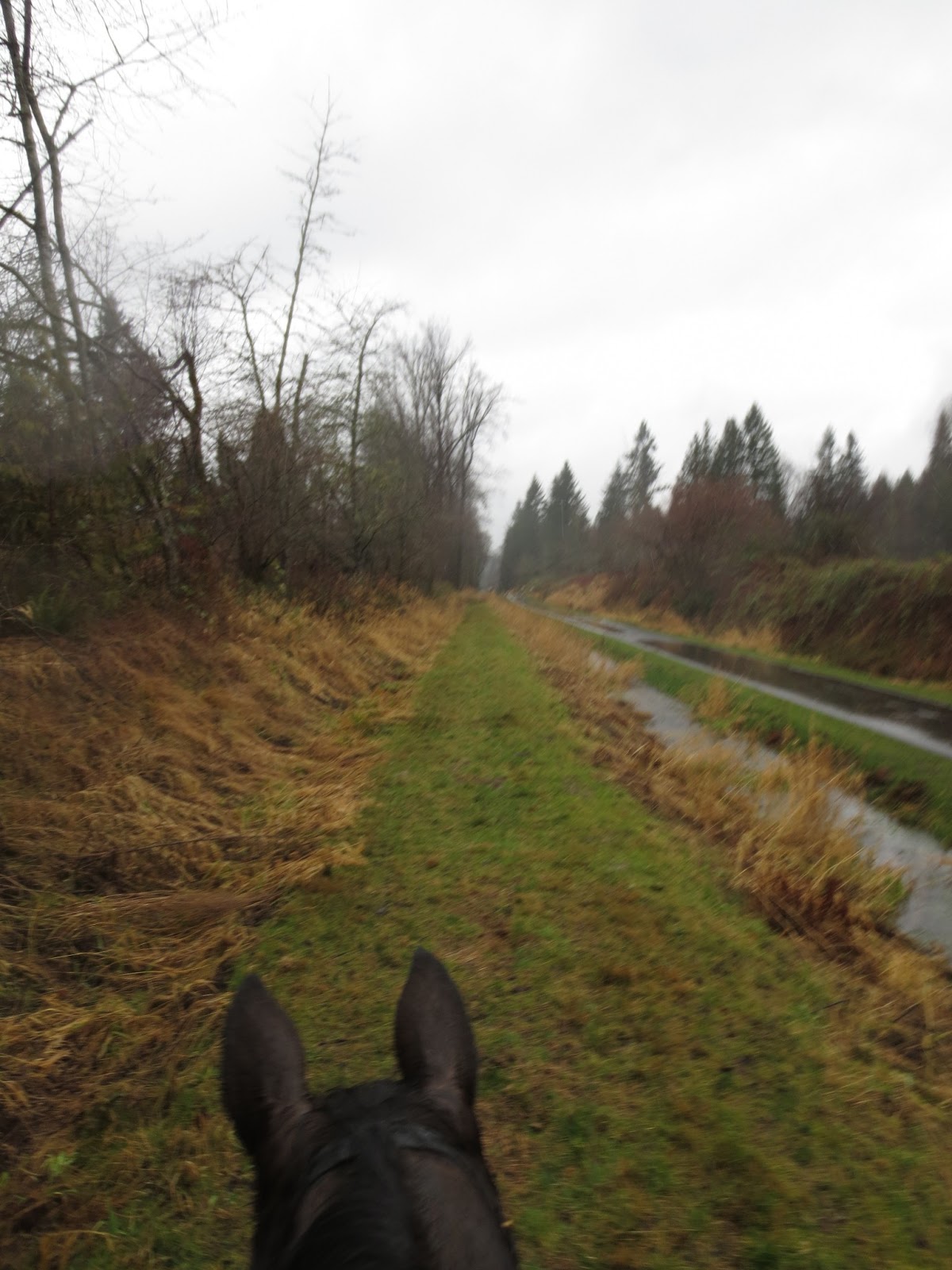
 |
| Ears at the bottom: Fiddle and Hana |
I'm just getting the hang of MapMyRun, so here's my experimental trail map insertion:
This new trail is an add-on to the Centennial Trail, a rail-trail conversion project that was begun in 1989, the centennial of Washington State (hence the name). With the new bit (including a new trailhead),
 |
| View of the Nakashima Barn from the horse-trailer parking lot |
the trail is now 30 miles long, stretching from the Skagit/Snohomish County border to downtown Snohomish. Details about the trail (including plans for expansion and hopes for future connections with other trail systems) are HERE.
The Nakashima Barn trailhead is of tremendous historical interest, and there are tons of interesting details HERE. Here's the short version:
This farm was originally part of the Bass Lumber Company. In 1937 1,200 acres were sold to Takeo Nakashima, eldest American-born son of Kamezo and Miye Nakashima (and thus, the first in the family legally allowed to buy and sell property in the United States).
 |
| close-up of one of the oversized photos mounted on the Nakashima Barn |
The Nakashima family planted pasture where the Bass family had cut down trees, and began to run dairy cattle on the farm. Without electricity, up to 40 cows were milked twice each day by hand.
In 1942, President Franklin D. Roosevelt signed Executive Order 9066, ordering nearly 120,000 West Coast persons of Japanese ancestry to relocate to internment camps. Kamezo and Miye Nakashima were sent to the Tule Lake Internment Camp. Takeo Nakashima was ordered to go to Minidoka Internment Camp. Before leaving, he sold the farm to Iver Drivstuen.
 |
| Vintage photos decorate the exterior of the barn |
Reportedly, Mr Drivstuen came to the Nakashima Farm to buy a bull and was told that in order to buy the bull he would have to buy the entire farm, which he did for $12,825 (about $10 per acre).
The Nakashima Farm was eventually deeded to Snohomish County for use as a park, and is now the northernmost trailhead of the Centennial Trail.
 |
| Duana and Hana appreciate good parking for the rig! |
There is a separate parking lot for horse trails, with enough room for about 6 rigs (or 10 rigs if they are parked by endurance riders).
Let me say some good stuff about the trail:
 |
| Lots of room for ponies...and the Dragon |
The trail designers clearly want to give ponies enough room. "Horse space" is either a very wide shoulder next to the paved trail, or a separate parallel trail nearby, usually wide enough that you could drive a truck on it.
Traffic crossings
 |
| Horses can see the bicycles and bicyclists can see the horses. That's a good thing. |
are clearly and safely marked. Note the clear sight-lines to avoid conflict between ponies and wheels. Excellent job, gang. We all appreciate lack of conflict!
At the place where we needed to cross Highway 9 (a very busy road)
 |
| Easy to reach! |
The bridges are wide and well-constructed, with hurricane-fence side rails and cement decking that is properly textured to allow good traction even in borderline-icy conditions. It was 45 degrees today, so ice wasn't a problem, but we had copious rain and a bad bridge deck would have been slick. This bridge over Pilchuck Creek wasn't even slightly slippery. Well done, bridge crew!
 |
| Duana leads Hana across the bridge over Pilchuck Creek |
The bridge also allowed good sight lines so that we could see the approaching bicyclist
 |
| We talked to this nice lady, and she fed the horses some cookies (we carry cookies so friendly bicyclists can do that) |
and she could see us. It's easy to avoid collisions if you can see long distances!
Duana was nervous about crossing the bridge (it's pretty high up over the "creek") so she walked beside Hana the first time we crossed it.
 |
| Hana is clearly not concerned about the bridge |
I stayed in the saddle, and on the way back, Fiddle and I led across the bridge.
 |
| The Dragon's "cautionary ears", which warn those handrails to stay where they belong! |
When we got to the other side, Du was regretting that she hadn't tried riding across it.
Well, duh. The bridge is still right there.
So, we crossed it again--
 |
| Du is happy. Hana is sure that she would be happier if somebody would hand over a cookie. |
and this time, she rode it!
Here's more good stuff: we saw blobs in the trees.
 |
| Blobs! Isn't that exciting! |
Close-up/cropped version of the blob:
 |
| Mature bald eagle, looking for fish in the creek |
I'm spoiled when it comes to eagle sightings. This time of year it's not unusual for me to see 6 or more bald eagles sitting in trees or fishing in the river every morning as I drive to work. But still, it's cool to see them without a truck windshield between us.
So, that was the good stuff. Now, here's some stuff that is problematic. First, something small:
 |
| Fiddle says: "No way!" |
It's a good idea, when directing humans to change "lanes", to give them some color-coded indication of where you want them to be.
Horses, however, view sudden changes in the comparative lightness/darkness of the trail as Something Truly Evil and Frightening. Even a Sensible Horse like Fiddle refused to touch this white pavement the first time she saw it. Too scary. Too dangerous. Best to go wa-a-a-a-y far around.
You know, I've spent years getting this mare to make good decisions about terrain. From her point of view, it totally makes sense to stay away from this weird bit of pavement! Though the designers did add a cute touch to it:
 |
| Real horse shoes--draft horse size--embedded in the cement |
Pretty. But not something a horse-person would ever have designed.
The "horse crossings" are a minor problem. With practice, a horse will learn to ignore instinct and walk on the scary white pavement.
A much bigger problem is the horse trail itself:
 |
| Do you see the problem? |
This trail is FLAT. Total elevation gain on our 5 miles out/5 miles back ride was 196 feet--less elevation change than I have from the top of my driveway to the bottom of my pasture.
This trail is through a SWAMP. I know, I know: I always say that this entire half of Washington State is a swamp...but in this case, you can literally see
 |
| Non-moving water is a bad thing...especially when it's on your trail. |
real, true, Swamp stuff while standing on the trail.
The problem : FLAT + SWAMP = WATER THAT DOESN'T MOVE. A flat trail bordered by swamp does not leave anywhere for water to escape. The result:
 |
| We only counted 6 or 8 sets of hoofprints in addition to ours. That's not very many animals to rip up a trail so completely... and this is a public trail that will (hopefully) see a lot of use, even in the wet months. |
water doesn't escape. It flows off of the pavement, onto the "shoulder trail" designated for horses, and it Stays. Right. There.
For months.
 |
| We got off this stretch as soon as I took the photo. The mud is already deep enough to pull horse-shoes off. |
This trail, if not amended and armored promptly by a LOT of gravel, is going to end up hock-deep in shoe-sucking mud. And once it gets chopped up by horse feet it will never drain and will require an excavator to clear out so that gravel can be added. Yowch.
So, here's my proposal (which I will send this week to the Snohomish County Parks department):
 |
| We moved off the pavement into the mud to allow a flock of migrating bicycles to pass |
"Y'all bring the gravel. I will bring a crew of people to spread it. Together we can create a sustainable trail that will be usable by horses all year round--not just the two months of mostly-dry weather we sometimes get in the summer."
This trail is fixable, and it is worth fixing. It's gonna take a lot of gravel, and it will take a lot of people to move that gravel. But it's much easier to fix it before it gets torn to shreds.
 |
| This little stretch has just a bit of slope...enough to move the water from the trail to the drainage ditch nearby. |
So, Parks people, when you read this: I'm serious. Call me. We can do this.


Any dump truck driver worth his salt could spread a layer, however deep, straight from the truck onto that path. Would have to wait 'til things dry out a lot, however...
ReplyDeleteLooks like a lovely trail, minus the serious drainage problem - hope they're ready to listen and do something about it.
ReplyDelete30 miles???? That is awesome! I hope they get that gravel for the horse path, it would be really really nice to have access to that much trail for winter riding:)
DeleteI wonder what happened to the Nakashima family after the war? It's sad that they were forced to sell their farm and hard to believe that it actually happened here in the US in the just the last century.
What a great trail, and good for you, letting the parks department know of the one teeny (but vital) thing they missed. With that much effort put into the trail, they aren't going to want to have to close the shoulders. Too much revenue would (sorry about the pun) dry up!
ReplyDeleteI can't get started on what happened to the Nakashima family or we'd have a hostile take over of the comments section. (Japan born grandparents, both naturalized US citizens, bad outcome.)
Love the photos! Cracked up over Fee's dictator ears. :)
Very detailed assessment of the trail! We're so lucky to have it - it's been a long "labor-of-love" for the volunteers who's vision didn't wane from the early days forward. We hope for many more miles!
ReplyDelete